after…

“Shelter along the Appalachian Trail” by Carol M. Highsmith

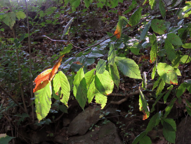
The forest behind my house is already becoming something new, I notice, as I walk trails that used to be shady. With so many fallen giants, the floor now lies under open sky. I count sprouting acorns by the dozens, arching their necks and reaching for a new bonanza of sunlight. I have so many hopes for this place I love. Mostly that we’ll rise like these seedlings from our scoured landscape, blessed with the kindness we’ve shared with our neighbors and the will to extend our care to those who follow behind us on these paths.
~ Barbara Kingsolver
(Southern Living, May 2025, “The Heart of Appalachia”)

On September 27 last year Hurricane Helene tore through Appalachia, affecting the community in Virginia where author Barbara Kingsolver lives. It also devastated 29 of North Carolina’s 100 counties, which are part of the same geographic region. (The county where we live is in the Piedmont region.) For some reason I never mentioned this disaster on this blog last year, probably because I couldn’t process what I was learning about it in real time.

Our grandchildren had no school that day so we had planned to take them to the Carolina Tiger Rescue. The day before, the weather forecasters warned of torrential rain for our area but the tour is by reservation only and the website said it would happen rain or shine. So we were prepared and bought rain ponchos for the four of us. But that morning the Rescue cancelled the tour and we stayed home. I’m glad we didn’t risk getting caught in a flash flood on the roads. It rained a lot and we had two tornado warnings during the day, which sent us to hunker down in the bathroom, but thankfully we weren’t hit. The disruption to our lives was nothing compared to what was happening to our neighbors only a few hours away.

A year earlier in October, we had stayed for a weekend getaway in the beautiful town of Black Mountain. We had a wonderful time walking through the town, visiting Mount Mitchell, hiking the Balsam Nature Trail in the state park, and driving along the scenic Blue Ridge Parkway. Little did we know Black Mountain would experience catastrophic flooding from the storm. Roads and bridges were damaged or washed away. The pictures we saw on the news were shocking and sobering. But since then the stories being shared of kind people helping one another have been heartwarming. I hope we can plan another visit some day.

However, the severely limited federal response under the current administration has been disturbing. According to our governor:

In addition to the $13.5 billion that I am requesting of Congress in new appropriations, North Carolina has yet to receive billions of dollars that Congress worked together on a bipartisan basis to appropriate last December. Just as I asked in February, I am urging federal agencies to take action to unlock those funds so we can put them to work as soon as possible where they are desperately needed.

We are grateful for every dollar that brings us a step closer to recovery, yet current federal financial support is not enough. In total, federal support amounts to approximately 9% of the total damage western North Carolina suffered. Many of the largest, most devastating storms, like Katrina, Maria, and Sandy, saw upwards of 70% of damage covered by federal funding, and from available historical data, the federal government has typically covered between 40 and 50 percent of costs caused by major hurricanes. The people of North Carolina deserve a fair shake, just like the residents of other states and territories.

~ Gov. Josh Stein
(Hurricane Helene Recovery, September 15, 2025, Federal Funding Request)

a tolerable day for a walk

8.22.25 ~ Bolin Forest

As we were driving out of our neighborhood we saw a fawn nibbling the grass on the side of the road. We pulled up near it and took some pictures. He/she was curious about us. When we decided to move on I suddenly spotted its mother hiding in the vegetation. She had no doubt been watching us the whole time.

mama had an eye on us

It was a tolerable day for a walk. The air wasn’t cool or refreshing like it would be in the fall, but it wasn’t unbearably hot. Dare I say lukewarm and muggy? But Tim decided he would like to give a walk a try. We needed to stop and rest frequently to accommodate his shortness of breath. It is what it is. I was just happy to be outside with my best friend. And the Riverwalk has benches.

Hillsborough Riverwalk

Last time we were here was July 7, just after Tropical Storm Chantal had dumped 10 inches of rain and had caused the Eno River to crest at over 25 feet, breaking previous records. It’s hard to imagine that everywhere we walked now had been under water. Some parts of the walk are still closed for repairs.

the water had come up over this footbridge
a piece of furniture, way above eye level,
caught in the trees
underneath the South Churton Street bridge
(Old NC 86)

It’s hard to imagine that the water flooded this bridge, too, and left so much debris underneath it that it’s hard to see the water now from the riverbanks.

looking at the sky from one of our resting benches
a fawn down by the river
a doe on the other side of the river
the opposite riverbank was pretty steep
fall webworm?
Occaneechi Indian Village

Occaneechi Village is a historic replica of a village located on the Eno River as it was in 1701. … In the early 1700s, the Occaneechi Band of the Saponi Nation lived in a bountiful land with little European presence. The village was an important trade location where the Occaneechi people would trade with the Europeans as well as nearby tribes such as the Tuscarora.
~ The Alliance for Historic Hillsborough website

This part of Riverwalk was closed until August 8 and the village itself is still closed while they keep working to repair the flood damage. In the next picture part of the village can be seen on the right, and the trees on the left are on the edge of the riverbank. Hard to imagine the water coming all the way up to the village!

flood debris from the structures caught in the palisade surrounding the village

Now, you might be wondering about this plucky katydid. Yes, it’s the same one pictured in the last post. She first appeared Thursday on the top of our car in the parking lot at Trader Joe’s in Chapel Hill. Tim took that picture with his cell phone. Much to our surprise, she was still on our car after we arrived home in Carrboro. We were even more surprised on Friday, when, after our walk, I noticed her sitting on the passenger side mirror of the car. (above picture) How did she manage to stay on the car from Carrboro to Hillsborough??? We nudged her but she stayed put. Well, when we got back to Carrboro, a 13-mile drive, she was clinging sideways to the car’s back door. So we decided to insist that she relocate and used a stiff tag to dislodge her and transport her to our back deck. (below picture) She didn’t stay there long, however. She waited until we stopped watching her so we missed her departure. I still wonder how she managed to hang on to the hot car for all those miles, over two days.

10 inches of rain!

7.7.25 ~ Hillsborough Riverwalk

Monday morning Tim was impressed to find 10 inches of rain in his gauge, from Tropical Storm Chantal. It was only a tropical depression when it got here Sunday afternoon, and there were no areal or flash flood warnings until after the storm was underway. Only then did the warnings start coming in. I lost count of how many times the warning alarms on my cell phone went off. Because we’re at a higher elevation and not in a flood zone we had no idea about what was unfolding in other parts of Carrboro and Orange County. But we knew it was raining hard here for a very long time.

Around noon we decided to drive up to Hillsborough to see what the Eno River looked like. The Riverwalk was closed because the river had flooded at least 19 feet above flood level and had damaged the wooden walkway. In these pictures it had receded some, but parts of the walkway were still under water. We met a public works employee who said they couldn’t open until the water receded, the damage was assessed, and repairs were made. She expects it to be closed for several weeks.

vegetation flattened by flood waters
public works employee inspecting damage
looks like a toy truck deposited upside down on the railing


7.7.25 ~ Bolin Creek, Umstead Park

Then we drove down to Chapel Hill to check out Bolin Creek. Not sure how high the creek had gotten but after we left and drove alongside it I saw a picnic table slammed into the bank of the creek. And a plastic chair caught on a tree a little farther along.

flood waters were here
debris caught in the footbridge railings
the water had definitely covered the footbridge
floodwaters knocked down signs

Several people we talked to were comparing this storm damage to what Hurricane Fran left behind in September 1996, but we weren’t here for that, so I couldn’t say. We didn’t go into the part of Chapel Hill that flooded and apparently made the national news, but I do wonder about our grocery store down there. We’ll see on Thursday, senior discount day, and therefore our food shopping day. 😉

I was impressed by the amount of debris caught on the footbridge

Today we’re under a heat advisory with heat index values ranging from 105°F to 109°F expected. We never lost power during the storm and I am so grateful to have air conditioning! We’re fine. But my heart goes out to those outside trying to clean up and repair damage after this storm.

a flooded cypress swamp

2.20.24 ~ Colleton State Park, Walterboro, South Carolina

On our way home from Georgia we stopped to stretch our legs at a state park in South Carolina. The nature trail we walked on followed a cypress swamp alongside the Edisto River. This river is the longest free-flowing blackwater river in North America and on this day it was flooding over into the swamp.

part of the boardwalk was submerged

A blackwater river is a type of river with a slow-moving channel flowing through forested swamps or wetlands. Most major blackwater rivers are in the Amazon Basin and the Southern United States.
~ Wikipedia

part of the boardwalk
some of the water came very close to the trail

When we talk of flood control, we usually think of dams and deeper river channels, to impound the waters or hurry their run-off. Yet neither is the ultimate solution, simply because floods are caused by the flow of water downhill. If the hills are wooded, that flow is checked. If there is a swamp at the foot of the hills, the swamp sponges up most of the excess water, restores some of it to the underground water supply and feeds the remainder slowly into the streams. Strip the hills, drain the boglands, and you create flood conditions inevitably. Yet that is what we have been doing for years.
~ Hal Borland
(Sundial of the Seasons)

This magical rest stop helped so much to break up the long journey home. The walk was a only a third of a mile, a perfect finale to a wonderful getaway. And it was so good to get home to North Carolina a few hours later.

do not use trail when flooded

9.15.23 ~ Bolin Creek Trail
Chapel Hill, North Carolina

At last, walking weather arrived Friday morning! We decided to try Bolin Creek Trail. It was a pleasant enough walk, but it was paved, which is hard on Tim’s back and hip. He needs uneven terrain to walk at all comfortably. And there were many joggers out and lots of people. There were cars zooming by on the road on the other side of the creek. It didn’t feel at all like a walk in the woods!

a burl on a loblolly pine tree

Still, we were delighted to be out getting some fresh air and moving our bodies for an hour. I doubt this will become one of our favorite walks but it was nice to get more familiar with what we have for options in our vicinity.

Hurricane Florence must have been a doozy back in 2018. Apparently Bolin Creek floods quite frequently but I haven’t been able to find out how high it was during that storm. I was standing on stairs leading up to the road to get the next three pictures. The tunnel goes under another road.

Tim standing under the high water mark
(see sign below)

There were some interesting tree roots along the mostly shaded creek.

bits of sunshine poking through the leaves
playing hide and seek with this squirrel
can you find him?
very tiny hemlock sapling trying to grow in the dark understory

Like Gold Park in Hillsborough that we visited a month ago, this trail had an urban feel to it. I think we’re going to have to venture farther from home to find some more woodsy walks to explore. I’m getting excited and hopeful about the possibilities.

that was indeed the rain

“Rain” by Edvard Munch

Like Rain it sounded till it curved
And then we knew ’twas Wind —
It walked as wet as any Wave
But swept as dry as Sand —
When it had pushed itself away
To some remotest Plain
A coming as of Hosts was heard
That was indeed the Rain —
It filled the Wells, it pleased the Pools
It warbled in the Road —
It pulled the spigot from the Hills
And let the Floods abroad —
It loosened acres, lifted seas
The sites of Centres stirred
Then like Elijah rode away
Opon a Wheel of Cloud —

~ Emily Dickinson
(The Poems of Emily Dickinson, #1245)

We got 1.75″ of rain on Tuesday! Our drought status has moved from severe down to moderate.

everything is flowing

Blue Marble image of North America
by NASA/NOAA/GSFC/Suomi NPP/VIIRS/Norman Kuring

In the belly of the furnace of creativity is a sexual fire; the flames twine about each other in fear and delight. The same sort of coiling, at a cooler, slower pace, is what the life of this planet looks like. The enormous spirals of typhoons, the twists and turns of mountain ranges and gorges, the waves and the deep ocean currents – a dragonlike writhing.
~ Gary Snyder
(A Place in Space)

Yet it is not our part to master all the tides of the world, but to do what is in us for the succor of those years wherein we are set, uprooting the evil in the fields that we know, so that those who live after may have a clean earth to till. What weather they shall have is not ours to rule.
~ J. R. R. Tolkien
(The Return of the King)

Contemplating the lace-like fabric of streams outspread over the mountains, we are reminded that everything is flowing — going somewhere, animals and so-called lifeless rocks as well as water. Thus the snow flows fast or slow in grand beauty-making glaciers and avalanches; the air in majestic floods carrying minerals, plant leaves, seeds, spores, with streams of music and fragrance; water streams carrying rocks both in solution and in the form of mud particles, sand, pebbles, and boulders. Rocks flow from volcanoes like water from springs, and animals flock together and flow in currents modified by stepping, leaping, gliding, flying, swimming, etc. While the stars go streaming through space pulsed on and on forever like blood globules in Nature’s warm heart.
~ John Muir
(Meditations of John Muir: Nature’s Temple)

Happy Earth Day!

after the superstorm

10.30.12 ~ Groton, Connecticut
a fallen tree across the street from our condo complex
10.30.12 ~ Groton, Connecticut

Tuesday morning we went down to see how our beloved beach had fared in the storm. We kept taking turns with the camera so I’ll credit us both with the pictures in this post! Beach Pond Road was closed to traffic so we walked by the pond on our way to Eastern Point Beach. The storm surge had breached the dunes separating the pond from Long Island Sound, and pushed the water and debris across the street and up onto the lawns across the street.

10.30.12 ~ Groton, Connecticut
Beach Pond Road
10.30.12 ~ Groton, Connecticut
the surge had not fully receded from its highest level
10.30.12 ~ Groton, Connecticut
view of the flooded Beach Pond,
dunes and Long Island Sound in the background
10.30.12 ~ Groton, Connecticut
same view, the bushes in the foreground were still surrounded by water

I think city workers had already plowed away the sand on the road because we were not at all prepared for the scene that awaited us when we got to the beach itself! The road there was covered with about a foot and a half of sand!

10.30.12 ~ Groton, Connecticut
Eastern Point Beach
10.30.12 ~ Groton, Connecticut
basketball court covered in sand
10.30.12 ~ Groton, Connecticut
looks like the top of a tree from who-knows-where
10.30.12 ~ Groton, Connecticut
Tyler House still surrounded by high water
10.30.12 ~ Groton, Connecticut
a park bench turned over and buried in the sand
10.30.12 ~ Groton, Connecticut
amazed that we could step over the buried chain link fence

More pictures coming soon!

full moon flood

Six inches of rain for us from this storm! Connecticut is having its worst flooding since 1982. We live at one end of a road that cuts between two salt ponds. Our son and daughter-in-law live a mile down at the other end of this road. (Shea took the first picture from her end. I took the rest of the pictures from our end, which is just around the bend in Shea’s picture.)

We both live up on relatively high ground so we’re safe and sound. The white high water mark pole in the second picture is to measure storm surges in case we ever get a hurricane again as bad as the one in 1938. We’ve been instructed that we would need to evacuate if a category 3 or higher hurricane were ever to make its way here. What an exciting day it has been!

My daughter-in-law Shea wrote on Facebook:

OK just got back from rescuing my sister from work… She had to walk through water above her knees in order to get to us.. Got home and found out that the National Guard has all three ways to get to my house blocked… One of them was nice enough to move the road block so I could drive through the bumper high water… GO JEEP!!!!!