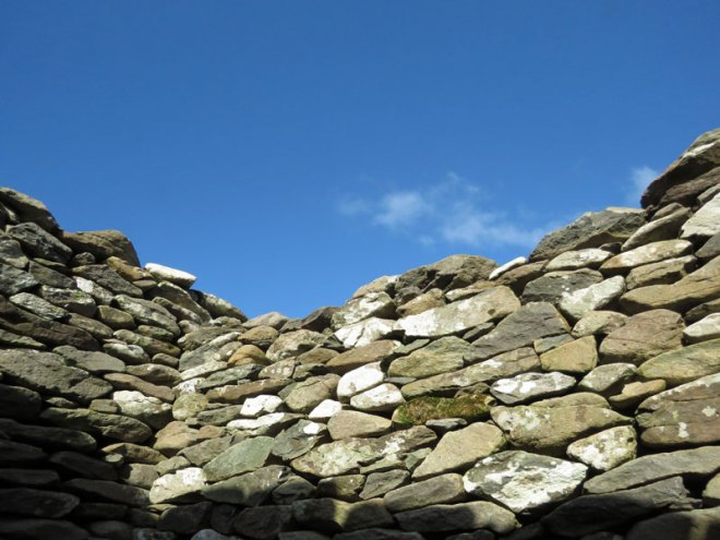
the muggies are back

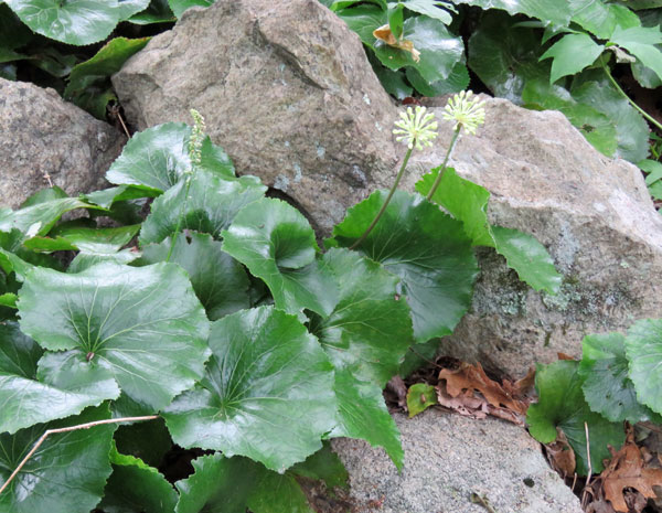
7.7.20 ~ tall meadow rue
Connecticut College Arboretum, New London, Connecticut

After all my kvetching on the last post a lovely day followed and we grabbed the opportunity for another early morning walk. Having visited the arboretum in early May and early June, we decided to see what might be blooming in early July. Fewer flowers but a lot more greenery.

The local weather forecaster has announced that “the muggies are back.” Dewpoints in the 70s! Tropical air is upon us and we might get a tropical depression storm Friday and Saturday. So glad we grabbed this walk when we had the chance. Enjoy!

The Bee is not afraid of me.
I know the Butterfly —
The pretty people in the Woods
Receive me cordially —

The Brooks laugh louder
When I come —
The Breezes madder play;
Where mine eye thy silver mists,
Wherefore, Oh Summer’s Day?

~ Emily Dickinson
(The Poems of Emily Dickinson, #113)

We didn’t see any “pretty people,” but felt the presence of fairies at every turn. No birds, except for one catbird who was so busy he was out of sight before I thought to try and get its picture.

tall meadow rue
red clover

O sweet the dropping eve, the blush of morn,
The starlit sky, the rustling fields of corn,
The soft airs blowing from the freshening seas,
The sunflecked shadow of the stately trees,
The mellow thunder and the lulling rain,
The warm, delicious, happy summer rain,
When the grass brightens and the days grow long,
And little birds break out in rippling song!

~ Celia Thaxter
(Compensation)

buttercup
common mullein

Please note: I haven’t posted any pandemic statistics since June 17 because many have said dwelling on the numbers produces anxiety. But for me it has the opposite effect. The numbers are a picture of the reality which keeps my imagination from running wild and panicking. I like to know what I’m up against and how best to proceed. And lately I’ve been struggling to cope with my fears. Maybe it’s because I stopped paying attention to the facts. So when I record the latest statistics in my posts, at the end sometimes, please don’t feel obliged to read them. They’re mainly for my own sanity!

We now have 135 confirmed cases of COVID-19 in our town. Our county (New London) has 1,304 confirmed cases. Of those 1 is still in the hospital and 102 have lost their lives. The last number (102) hasn’t changed since June 17, so our county hasn’t had any deaths in weeks. One thing that reminded me to start checking the statistics again is that on Tuesday, on the local news, they announced that Connecticut had its first day ever with no COVID-19 deaths reported state-wide. Our governor has a well-deserved 78% approval rating. He recently decided that bars will not be opening on July 20 even though we’re doing well. He cited what’s been happening in other states when they open their bars. I am grateful for his leadership.

morningtide

6.24.20 ~ Eastern Point
Canada goose papa watching over his family in Avery Pond

One morning, four days after the beach “opened” for the season on June 20, we got up early and headed down there before it opened for the day. What a difference! Now that people have to pay for a pass to enter between 8am and 8pm the freeloaders and all their litter, cigarette butts and dog crap have disappeared. Peace is restored and we had such a lovely walk!

killdeer parent and three tiny chicks
near Avery Pond
killdeer on the run after the speedy little chicks

In contrast to the tranquil Canada goose family, the killdeer parents were beyond frantic, chasing after and chirping to their three chicks, who were darting all over the place and in every direction. It made getting their pictures next to impossible! They blended in well with the gravel.

the morning dew promised a humid day

Someone is tending some beautiful rose bushes near the entrance, along the chain link fence.

rose and chain link fence

I love the contrast between rusty old metal and fresh new flower.

rose and buds

The water was very calm on the river/estuary side of the point.

juvenile gull
female common eider
flying over the Thames River estuary
underwater and above-water seaweed
please, please, please

Another risk factor to worry about:

The two stretches of DNA implicated as harboring risks for severe COVID-19 are known to carry some intriguing genes, including one that determines blood type and others that play various roles in the immune system. In fact, the findings suggest that people with blood type A face a 50 percent greater risk of needing oxygen support or a ventilator should they become infected with the novel coronavirus. In contrast, people with blood type O appear to have about a 50 percent reduced risk of severe COVID-19.
~ Dr. Francis S. Collins
(Genes, Blood Type Tied to Risk of Severe COVID-19,
NIH Director’s Blog, June 18, 2020)

I have type A blood. Fortunately my husband, children, and grandchildren are all type O. Reading this article made me glad that we haven’t let our guard down and continue to remain firmly self-quarantined. And now our governor has ordered out-of-state travelers to quarantine for two weeks when entering Connecticut because of the way COVID-19 is spreading like wildfire in so many other states. I’m glad to know he is still looking out for us. The numbers are getting very alarming again.

It’s good to know my beach sanctuary is available to me again, at least for the summer. Looking forward to many early morning walks on the sand.

The salt of those ancient seas is in our blood, its lime is in our bones. Every time we walk along a beach some ancient urge disturbs us so that we find ourselves shedding shoes and garments, or scavenging among seaweed and whitened timbers like the homesick refugees of a long war.
~ Loren Eiseley
(The Unexpected Universe)

gull tracks

I like this place, and willingly could
Waste my time in it.

~ William Shakespeare
(As You Like It)

? near Beach Pond
red-winged blackbird near Beach Pond

We are nature. We are nature seeing nature. The red-winged blackbird flies in us.
~ Susan Griffin
(Made from this Earth: An Anthology of Writings)

in this very present moment

6.4.20 ~ beach rose
Napatree Point Conservation Area, Watch Hill, Rhode Island

Along the shoreline, about 19 miles east of us, the waters of Fishers Island Sound give way to the the bigger waves of Block Island Sound and the Atlantic Ocean. When leaving Connecticut and arriving in Watch Hill, Rhode Island, the terrain and the beaches feel a lot more like Cape Cod to me. The irresistable desire to hear those waves crashing led me to drag Tim to Napatree Point Thursday morning and he was a good sport about a hike over the dunes.

Napatree Point is a slender, 1.5 mile long peninsula in Block Island Sound. To the north of the peninsula is Little Narragansett Bay, a small estuary into which the Pawcatuck River empties. The small bay is an inlet of the Atlantic Ocean.
~ Wikipedia

dunes

First we walked along the bay side, but not all the way to the end of the peninsula. The water was calm and there were lots of birds busy fishing and flying, but only one herring gull. He was quite handsome and paid no attention to us.

What is it with me and gulls? I won’t say how many pictures I wound up taking of this one. 🙂 But the sound of the waves on the ocean side was beckoning…

Time to take a shortcut over the dune. We made it across without encountering someone coming the other way. With COVID-19 ever on our minds we knew it would have to be a one-way-at-a-time bridge.

The waves were relatively calm, but bigger than the ones at our beach, and the sound of them crashing was soothing to me.

Atlantic Ocean!

Till my soul is full of longing
For the secret of the sea,
And the heart of the great ocean
Sends a thrilling pulse through me.

~ Henry Wadsworth Longfellow
(The Secret of the Sea)

Watch Hill Lighthouse on the point in the distance

There was a family with two children playing there on the beach. When we got closer the parents called the little ones back to their blanket and we hugged the water, putting as much distance between us as possible. We didn’t linger so the kids could quickly get back to their playing by the water. Life in the time of coronavirus.

I’ve been wrestling with several other concerns, though. Perhaps it’s stress, but my migraines have come back and have become very frequent, waking me up almost every night. Fortunately I have a stash of meds but I’m starting to worry I will blow through it before my next refill is due.

And then there is what I thought were spider bites I woke up with last Saturday morning. Mostly on my belly, a few on my face, and a couple of days later, a spot on my ankle. By the middle of the week I suspected flea bites or chigger bites. But the itching and rash now feels exactly like poison ivy. Which means I’ve got another week or two of this misery to live through. Probably picked it up in the woods on one of our walks. I think I will confine our walks to the cemetery and dirt roads for now.

Seeing the open ocean, hearing the waves, smelling the salty air, picking up a shell to remember the morning, all of it gave me some breathing space. Even the incessant itching seemed to stop for a while.

time to climb over the dune again

Try to be happy in this very present moment; and put not off being so to a time to come: as though that time should be of another make from this, which is already come, and is ours.
~ Thomas Fuller
(A Dictionary of Thoughts: Being a Cyclopedia of Laconic Quotations from the Best Authors of the World, Both Ancient & Modern)

This morning I read that headaches are one of the possible side effects of hydrocortisone cream, which I’ve been using on the poison ivy. Itching, too. So I’m going to stop using it for a while and see what happens. This too, will pass.

Watch Hill Lighthouse
looking back across Napatree Point from the top of the dune

I was very sorry to leave but very grateful to have enjoyed our moments there. On our way out we managed to stay far enough away from a couple of people arriving and exchanged greetings from behind our masks. “It’s the new way,” one man observed, as we all did our do-si-dos along the paths.

in the horizon

5.3.20 ~ Avery Point

The health of the eye seems to demand a horizon. We are never tired, so long as we can see far enough.
~ Ralph Waldo Emerson
(Nature)

Tim likes to point out that you can see four lighthouses from a certain place along this walk. It’s fun to look out at the horizon and try to identify different kinds of ships. We don’t see as many as we used to, but I think the ferries to Long Island are still running…

5.3.20 ~ Avery Point Light, the closest, on UConn campus

Avery Point Lighthouse is a lighthouse in Groton, Connecticut, on the Avery Point Campus of the University of Connecticut. Although construction was completed in March 1943, the lighthouse was not lit until May 1944 due to concerns of possible enemy invasion.
~ Wikipedia

5.3.20 ~ Race Rock Light, the most distant, eight miles away

Race Rock Lighthouse stands in Long Island Sound, 8 miles (13 km) from New London, Connecticut, at the mouth of the Race where the waters of the Sound rush both ways with great velocity and force.
~ Wikipedia

I’ve been told that Race Rock Light marks where Long Island Sound ends and the Atlantic Ocean begins. I got a good picture of it in 2012 when we took a ferry to Block Island. See picture here.

5.3.20 ~ New London Ledge Light, in Long Island Sound

New London Ledge Lighthouse is a lighthouse in Groton, Connecticut on the Thames River at the mouth of New London harbor. It is currently owned and maintained by the New London Maritime Society as part of the National Historic Lighthouse Preservation Act program.
~ Wikipedia

5.3.20 ~ New London Harbor Light, across the Thames River

New London Harbor Light is a lighthouse in New London, Connecticut on the west side of the New London harbor entrance. It is the nation’s fifth oldest light station and the seventh oldest U.S. lighthouse. It is both the oldest and the tallest lighthouse in Connecticut and on Long Island Sound, with its tower reaching 90 feet. The light is visible for 15 miles and consists of three seconds of white light every six seconds. It was listed on the National Register of Historic Places in 1990. It is currently owned and maintained by the New London Maritime Society as part of the National Historic Lighthouse Preservation Act program.
~ Wikipedia

5.3.20 ~ meteorological mast

The Meteorological Tower on the University of Connecticut Avery Point Campus measures wind speed and direction (anemometer), atmospheric pressure (barometer), relative humidity, rainfall (rain gauge), air temperature (thermometer), radiation from clouds and sky (pyrgeometer), and solar radiation (pyranometer). It also provides pictures of Long Island Sound. Anemometer height is approximately 37 feet above the water surface.

I cross till I am weary
A Mountain — in my mind —
More Mountains — then a Sea —
More Seas — And then
A Desert — find —

And my Horizon blocks
With steady — drifting — Grains
Of unconjectured quantity —

~ Emily Dickinson
(The Poems of Emily Dickinson, #666)

5.3.20 ~ weather station
5.3.20 ~ I love the sound this buoy’s bell makes

Feeling is deep and still; and the word that floats on the surface
Is as the tossing buoy, that betrays where the anchor is hidden.

~ Henry Wadsworth Longfellow
(Evangeline)

5.3.20 ~ an amazing tree

That way I looked between and over the near green hills to some distant and higher ones in the horizon, tinged with blue. … There was pasture enough for my imagination. … ‘There are none happy in the world but beings who enjoy freely a vast horizon,’ said Damodara, when his herds required new and larger pastures.
~ Henry David Thoreau
(Walden)

our bubble

4.14.20 ~ morning moon

As we continue to carve out a new life for ourselves in quarantine, we have started referring to “our bubble.” Stay safe, stay home. We are wary of popping our bubble by some careless slip of protocol. We care for our safe zone (our bubble) and speak of it fondly sometimes, as we tend to it like one would a houseplant or a pet.

4.14.20 ~ Elm Grove Cemetery, Mystic, Connecticut

Yesterday we went for an early morning walk at Elm Grove Cemetery in Mystic. It’s a large scenic resting place along the Mystic River, just north of Mystic Seaport. The seaport is closed for the pandemic and many (most?) of its employees have been laid off. We parked at the south end of the graveyard where we could see the dockyard across the water and also explore the fascinating carvings on the gravestones of past sailors.

4.14.20 ~ Mystic Seaport from a distance
4.14.20 ~ sailing poetry on a headstone
4.14.20 ~ Mystic Seaport buildings

We’re going to renew our membership to Mystic Seaport anyway. Even though we have no idea when it will be safe to visit again.

4.14.20 ~ looking across the Mystic River

I’m pretty sure that cliff and house (above) are part of the Peace Sanctuary, where Janet, her mom and I took a lady slippers nature walk back in 2013. See lady slippers.

4.14.20 ~ Draken Harald Hårfagre, still covered for winter

Will the Viking ship have any adventures this year? I have my doubts there will be a Viking Days festival this June…

4.14.20 ~ a soggy stuffed bunny hiding
4.14.20 ~ New London Ledge Lighthouse
4.14.20 ~ one of the cemetery’s peaceful ponds
4.14.20 ~ a lighthouse for a monument
4.14.20 ~ a small decorative well that Tim loved
4.14.20 ~ another peaceful pond

And we finally came around back to our car. Can’t believe it’s six years old! In some places folks aren’t permitted to drive somewhere to take a walk but we are, thankfully. Tim says it isn’t good for cars to sit without running for long periods of time. Our car is an important part of our bubble!

This was our first walk where we did not encounter a single person! Not sure if it was the location or the time of day that did the trick. I suspect there will be more cooler early morning walks as the warmer summer days come along. As long as we can manage to stay safe in our bubble.

We now have 21 confirmed cases of COVID-19 in our town.

a fisherman knows

“Fishing Boats, Calm Sea” by Claude Monet

The will in the wind and the weather,
The voice that calls and whispers…
Whether doubter or believer,
a fisherman knows this of “Him”
if he lives in the storm, He lives
also in the sunset’s glow,
and in the red of the morning.

~ Gunnar Reiss-Andersen
(Sea & Sky)

Inch (Ínse)

2.4.18 ~ Inch Beach, Kerry, Ireland

Next stop was Inch Beach! Another location where part of Ryan’s Daughter was filmed.

2.4.18 ~ Inch Beach, Kerry, Ireland ~ the scenery was indeed breathtaking

Inch or Ínse meaning Sea Meadow (Oilean Ínse – Island of Inch) is best known for its impressive Blue Flag beach. It offers miles of golden sand and breathtaking scenery showcasing mountain, beach, valley and sea. Standing on the beach, the 360 degree panoramic view before you encompasses the McGillycuddy Reeks, Rossbeigh Beach and the northern shores of the Ring of Kerry, Dingle Bay and the Atlantic Ocean, the Slieve Mish Mountains which form the backbone of the Dingle Peninsula and the magnificent sand dunes that stretch along this amazing sand spit. A majestic setting, which has inspired artists, poets, writers and was chosen as the location for the Hollywood films Ryan’s Daughter and Playboy of the Western World.
~ GoKerry website

2.4.18 ~ another adventure with her Papa
2.4.18 ~ sand, sea and sky as far as the eye can see
2.4.18 ~ Inch Beach, Kerry, Ireland
2.4.18 ~ Katherine drawing on the sand with Papa
2.4.18 ~ amazing vistas even if my family was all looking down for shells
2.4.18 ~ it’s good to know there is still much beauty left on earth
2.4.18 ~ uncounted shells, beauty in the small details
2.4.18 ~ time to turn around and walk all the way back
to find lunch in the restaurant on the right

After a nice long meandering walk on Inch Beach we had lunch in a crowded beach restaurant. The parking lot was full so some cars were parked right on the sand. And so we were off to our next destination where I encountered my first Irish forest.

Caher Conor (Fahan Beehive Huts)

2.4.18 ~ Caher Conor, Mount Eagle, Kerry, Ireland
not sure if the 2,000 BC date is accurate ~ other sources suggest the 12th century

Sunday happened to be Imbolc, Groundhog Day, Candlemas or Brigid’s Day, about halfway between the winter solstice and the spring equinox. It marks the beginning of spring, which I now see comes a lot sooner in Ireland than it does in New England. Our first stop was at these fascinating beehive huts.

the canine proprietor greeting us was eager to sell us tickets
the ticket booth was a bit run down but Larisa found him friendly enough
Dima, Katherine and Tim had already started the 2-minute walk up the mountain path
the path narrows
stone wall path boundary
2.4.18 ~ Caher Conor, Mount Eagle, Kerry, Ireland
looking back down at the sea behind us
I loved the lichens on the stones and the little green mosses and plants
2.4.18 ~ Caher Conor, Mount Eagle, Kerry, Ireland

Also known as the Fahan Beehive Huts, Caher Conor (Cathair na gConchuireach) is located on the south side of Mount Eagle west of Dingle. The complex consists of five structures.

The clochan (beehive huts) in Caher Conor were probably single family dwellings and were attached to each other with a doorway leading from one to the other. They were built in the form of a circle of successive strata of stone, each stratum lying a little closer to the center than the one beneath and so on up to a small aperture at the top that could be closed with a single small flagstone or capstone. No mortar was used in building, which is called corbelling.

The hillside at one time had over 400 of these drystone, corbelled huts surviving, prompting one antiquarian in the 19th century to refer to the area as the “City of Fahan”. Dating the huts is difficult because the skill of corbelling has been used in Newgrange (3100 B.C.) and as recently as the 1950s. The huts at Fahan along the Slea Head Drive may well date to the 12th Century when the incoming Normans forced the Irish off the good land and out to the periphery of the Dingle Peninsula.

~ Saints & Stones website

2.4.18 ~ Caher Conor, Mount Eagle, Kerry, Ireland
this enclosure didn’t have a roof
Larisa coming through a doorway
2.4.18 ~ Caher Conor, Mount Eagle, Kerry, Ireland
Katherine going through a doorway
2.4.18 ~ Caher Conor, Mount Eagle, Kerry, Ireland
orbs ~ I found the one with the bright center very interesting
it was so cold that Katherine finally relented and put her coat on
~ notice the pink plastic spoon in her hand ~
it was with her most of the day
Larisa and a gorgeous view
Dima and another view
this cross would make more sense being here if the wall was built in the 12th century
2.4.18 ~ Caher Conor, Mount Eagle, Kerry, Ireland
Barbara & Tim with orbs ~ Larisa knit the hat from Irish wool ~ at first she let me borrow it but then she gave it to me ~ now I have wool hats from Ireland and Norway!
I think Ireland may have even more stones than New England does!
2.4.18 ~ view from Caher Conor, Mount Eagle, Kerry, Ireland
coming around a corner
the walk back down to the parking lot
2.4.18 ~ Caher Conor, Mount Eagle, Kerry, Ireland
the canine proprietor keeping tabs on our departure
a door on a nearby building
the side of the same building, set well into the steep mountainside
the narrow, one-lane road between the entrance
and the tiny parking lot
2.4.18 ~ Caher Conor, Mount Eagle, Kerry, Ireland
view looking down from the parking lot ~ yikes!

It was good to get warmed up in the car and drive off for our next destination.