10.16.23 ~ Occoneechee Mountain State Natural Area Hillsborough, North Carolina
So far the fall color here is pretty patchy. Occoneechee Mountain is the highest point (867 feet) here in Orange County, where we now live. So Monday we climbed a trail up to the top to see what the view might be like. Even though we see deer almost every day in our yard it’s still a thrill to see a wild one out deep in the woods.
getting ready to cross the trail
she spotted me as I zoomed in
proceeding across the trail
approaching the overlook
a view from the overlook
a side view from the overlook
part of Hillsborough below us
Eno River, 350 feet below the overlook
On our way back to the parking lot we heard quite a commotion in involving several crows and possibly another kind of bird. We kept stopping to try to see what was going on, but we never saw anything.
Part of me thought perhaps we had chosen the wrong week to visit Mt. Mitchell, that we might have waited a week in order to see more fall colors. Well, it turns out it was a good thing we didn’t go a week later. They had enough snow over there in the mountains to close Mt. Mitchell State Park and 37 miles of the Blue Ridge Parkway. We would not have been able to go see any of what we did!
10.10.23 ~ view of Glassmine Falls Blue Ridge Parkway, Pisgah Region, North Carolina
On our way back to our hotel in the charming little town of Black Mountain we retraced our drive along the Blue Ridge Parkway. This overlook was especially beautiful. We saw some fall colors but they hadn’t come to a peak yet.
The waterfall (below) was dry on this day but apparently after a good rain a narrow stream of water falls 200 feet over the cliff. That dark hole at the base is an old mica mine. Mica is sometimes called isinglass and miners called it glass for short, which is why it was called a glassmine.
Glassmine Falls
valley on the other side of the overlook
path back to parking lot, elevation 5,200 feet
The clouds were always on the move, casting dramatic shadows over the peaks and valleys and changing the lighting moment to moment. It was a nice way to end a most wonderful day.
10.10.23 ~ start of Balsam Nature Trail Mount Mitchell State Park
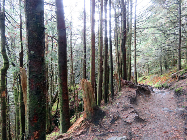
Another trail! After visiting Mount Mitchell’s peak we found the Balsam Nature Trail, a 3/4 mile loop off of the Summit Tower Trail. The terrain here was very uneven, much to Tim’s relief after the flat pavement going up to the summit. Lots of up and down, even steps in some places and narrow passages between outcrops.
We didn’t encounter any wildlife or hear any birds calling. I’m guessing because this is a well-traveled trail and the creatures are hiding from people, if they are there at all. Every few minutes a couple or a family or small group of friends would overtake us and pass us. And just as often we’d pass folks hiking in the opposite direction. It was the most traffic we’ve ever experienced on a trail.
huge outcrop
ferns everywhere
a hemlock sapling – good luck precious little being
The best part of this walk could not be photographed — it was the amazing scent of balsam and Fraser fir. What an unforgettable olfactory delight!
Sadly, though, there wasn’t much left of healthy evergreen foliage. Most of the green we saw was mosses and ferns.
I am very familiar with the hemlock woolly adelgid insect pest that destroyed the hemlock grove surrounding my childhood home. It originated in East Asia and arrived here in 1951. According to Wikipedia, by 2015 90% of the geographic range of eastern hemlock in North America had been affected.
But I had never heard of the balsam woolly adelgid until I saw it mentioned on a trailside sign, explaining why there were so many dead and dying trees in this forest. This insect pest arrived here from Europe in 1900 and was discovered in this forest in 1957. The devastation is obvious in many of these pictures.
Mosses and mushrooms seem to be thriving with such an abundance of dead wood. I tried to identify the moss in the above picture — it seems to be some kind of feather moss. It looked different than the mosses I usually see. According to Britannica there are approximately 12,000 species of moss distributed throughout the world.
The spruce-fir forest is a forest type dominated by needle-leaved, evergreen red spruce and Fraser fir trees. It exists only at elevations above 5,500 feet, and contains plants and animals that are adapted to cool, moist conditions. Some of the plants and animals living in Mt. Mitchell’s spruce fir forest are found over much of the state. Others, however, are the same as (or are close relatives of) those found in the spruce-fir forests of New England or southern Canada. ~ trailside sign
The climate of a spruce-fir forest can be harsh. Wind and ice storms are facts of life here: trees with their tops missing are common sights. And, as with any high-elevation ecosystem, rain, fog, sleet or snow can occur unpredictably — in any month, at any time of day. ~ trailside sign
uneven uphill terrain
halfway point
Though spruce-fir forests are found in a broad region of northern North America, they occur south of New England only in a thin zone along the Appalachian Mountain chain. ~ trailside sign
red spruce roots
All that being said, I was still enchanted with this forest and will cherish my memories of this little taste of New England here in North Carolina.
10.10.23 ~ start of Summit Tower Trail Mount Mitchell State Park, Burnsville, North Carolina
It was a steep quarter-mile trek from the parking lot to the summit and observation deck, but the view at the top of Mount Mitchell was well worth it!
Elisha Mitchell (August 19, 1793 – June 27, 1857) was an American educator, geologist and Presbyterian minister. His geological studies led to the identification of North Carolina’s Mount Mitchell as the highest peak in the United States east of the Mississippi River. … Elisha Mitchell fell to his death at nearby Mitchell Falls in 1857, having returned to verify his earlier measurements… ~ Wikipedia
looking up from along the trail
one of the rest stops Tim made good use of
a view from along the trail I believe these are other mountains in the Black Mountains range
After reaching the summit we went up a ramp to the observation deck. From there we had an impressive 360-degree view of forests, mountains and clouds, as far as the eyes could see.
On the way back down I started noticing the many kinds of lichens growing on the trees and the wooden fences.
Sometime back in the 1980s we took our kids on the Cog Railway up Mount Washington in New Hampshire. All this time I thought it was the highest mountain on the east coast, until moving to North Carolina and reading about Mount Mitchell, which is 396 feet higher!
Mount Washington, in New Hampshire, is the highest peak in the Northeastern United States at 6,288.2 ft (1,916.6 m) and the most topographically prominent mountain east of the Mississippi River. ~ Wikipedia
I can see what is meant by Mount Washington being the most topographically prominent mountain, though. Mount Mitchell is surrounded by other peaks in the Black Mountains range, which has 12 summits higher than Mount Washington’s.
I had another treat waiting for me as we headed back down the trail.
On Tuesday we left early to vote in the Connecticut primary and then drove down to the pond by way of the road along the Thames River. Some of the river’s banks are covered with an unattractive cement ramp, but, I happened to notice a swamp rose mallow popping through it as we were driving by.
Fascinated, I asked Tim to stop the car so I could hop out and examine the wildflower up close. How could it be growing in such an inhospitable spot? It wasn’t that big yet, maybe 2 feet tall, and I wonder how high it might be able to grow there. (They can grow to 7 feet, and the flowers are 4-6 inches in diameter.)
As I was enjoying the close encounter I noticed another wildflower growing through another seam. I loved the shades of purple on its petals.
Back in the car and on to the pond. So sad to see even less water remaining in it. I’m surprised the shorebirds don’t do their fishing over at the beach but they must have their reasons for hanging out here still.
drought-stricken Beach Pond
lesser yellowlegs
Nature, like a loving mother, is ever trying to keep land and sea, mountain and valley, each in its place, to hush the angry winds and waves, balance the extremes of heat and cold, of rain and drought, that peace, harmony and beauty may reign supreme. ~ Elizabeth Cady Stanton (Elizabeth Cady Stanton, Feminist as Thinker: A Reader in Documents & Essays)
great egrets strolling by
snowy egret with lesser yellowlegs behind him
snowy egret
great egrets mingling with snowy egrets
swamp rose mallow, this one growing by the pond
We’re supposed to get a break from the heat and humidity this weekend, which will be nice, but we also need some rain!
Boatman, I am a river I am a mountain, to the sea Boatman, taker, and giver Can you deliver for me? And can I forever run free? ~ Livingston Taylor ♫ (Boatman) ♫
“At the First Touch of Winter, Summer Fades Away” by Valentine Cameron Prinsep
The days move more swiftly now, too, with late dawns and early dusks. The days march toward the winter solstice like a winter farmhand with the wind at his back. And the long nights become the sleep of the earth itself, the rest, the waiting.The fox barks in the night, in the glitter of winter starlight. The deer shelter in the hemlock thickets on the mountain. The woodchuck sleeps, breathing only once in five minutes. And that hurrying wind whistles in the naked maples. November is at hand. This is the hurrying, impatient wind of winter that I hear in the night. ~ Hal Borland (Hal Borland’s Book of Days)
The health of the eye seems to demand a horizon. We are never tired, so long as we can see far enough. ~ Ralph Waldo Emerson (Nature)
Tim likes to point out that you can see four lighthouses from a certain place along this walk. It’s fun to look out at the horizon and try to identify different kinds of ships. We don’t see as many as we used to, but I think the ferries to Long Island are still running…
5.3.20 ~ Avery Point Light, the closest, on UConn campus
Avery Point Lighthouse is a lighthouse in Groton, Connecticut, on the Avery Point Campus of the University of Connecticut. Although construction was completed in March 1943, the lighthouse was not lit until May 1944 due to concerns of possible enemy invasion. ~ Wikipedia
5.3.20 ~ Race Rock Light, the most distant, eight miles away
Race Rock Lighthouse stands in Long Island Sound, 8 miles (13 km) from New London, Connecticut, at the mouth of the Race where the waters of the Sound rush both ways with great velocity and force. ~ Wikipedia
I’ve been told that Race Rock Light marks where Long Island Sound ends and the Atlantic Ocean begins. I got a good picture of it in 2012 when we took a ferry to Block Island. See picture here.
5.3.20 ~ New London Ledge Light, in Long Island Sound
New London Ledge Lighthouse is a lighthouse in Groton, Connecticut on the Thames River at the mouth of New London harbor. It is currently owned and maintained by the New London Maritime Society as part of the National Historic Lighthouse Preservation Act program. ~ Wikipedia
5.3.20 ~ New London Harbor Light, across the Thames River
New London Harbor Light is a lighthouse in New London, Connecticut on the west side of the New London harbor entrance. It is the nation’s fifth oldest light station and the seventh oldest U.S. lighthouse. It is both the oldest and the tallest lighthouse in Connecticut and on Long Island Sound, with its tower reaching 90 feet. The light is visible for 15 miles and consists of three seconds of white light every six seconds. It was listed on the National Register of Historic Places in 1990. It is currently owned and maintained by the New London Maritime Society as part of the National Historic Lighthouse Preservation Act program. ~ Wikipedia
5.3.20 ~ meteorological mast
The Meteorological Tower on the University of Connecticut Avery Point Campus measures wind speed and direction (anemometer), atmospheric pressure (barometer), relative humidity, rainfall (rain gauge), air temperature (thermometer), radiation from clouds and sky (pyrgeometer), and solar radiation (pyranometer). It also provides pictures of Long Island Sound. Anemometer height is approximately 37 feet above the water surface.
I cross till I am weary A Mountain — in my mind — More Mountains — then a Sea — More Seas — And then A Desert — find —
And my Horizon blocks With steady — drifting — Grains Of unconjectured quantity —
~ Emily Dickinson (The Poems of Emily Dickinson, #666)
5.3.20 ~ weather station
5.3.20 ~ I love the sound this buoy’s bell makes
Feeling is deep and still; and the word that floats on the surface Is as the tossing buoy, that betrays where the anchor is hidden. ~ Henry Wadsworth Longfellow (Evangeline)
5.3.20 ~ an amazing tree
That way I looked between and over the near green hills to some distant and higher ones in the horizon, tinged with blue. … There was pasture enough for my imagination. … ‘There are none happy in the world but beings who enjoy freely a vast horizon,’ said Damodara, when his herds required new and larger pastures. ~ Henry David Thoreau (Walden)